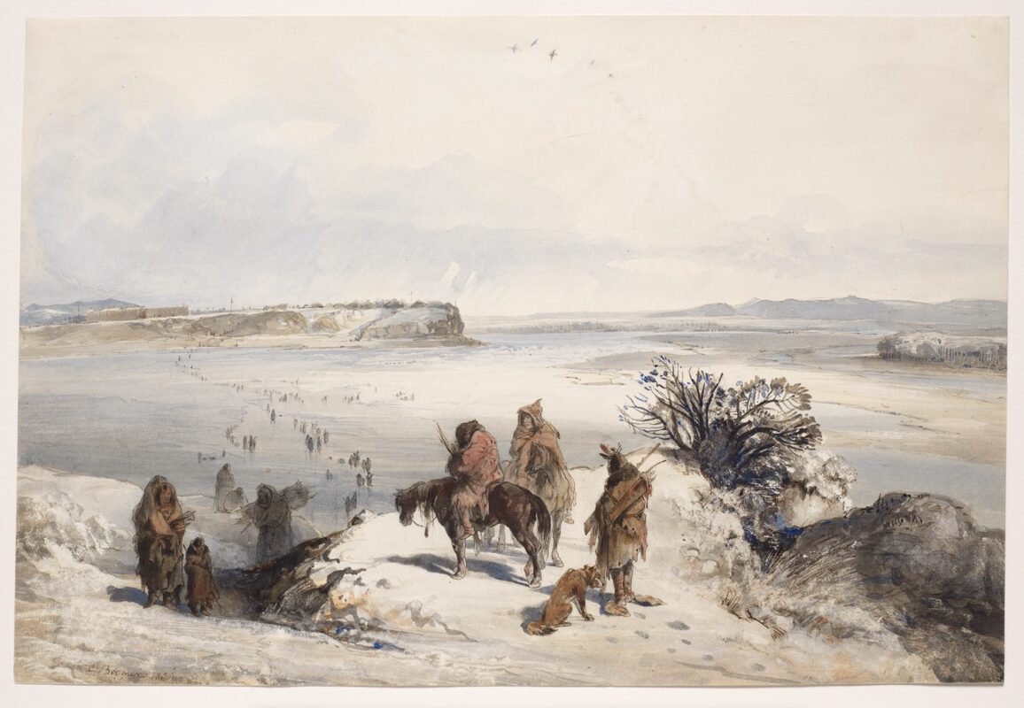
Mih-Tutta-Hangkusch, Mandan Village
Download
jpeg(127.48 kb)
For information on accessing a high resolution version of this image suitable for print reproduction please visit the Rights and Reproduction page.
Artist
Karl BodmerBirth and death dates
1809 - 1893Artist Nationality
SwissTitle
Mih-Tutta-Hangkusch, Mandan VillageDate
January 1834Dimensions
11 1/4 × 16 5/8 in. (28.6 × 42.2 cm)Medium
Watercolor and ink on paperInstitution
Joslyn Art MuseumCredit Line
Gift of the Enron Art FoundationAccession Number
1986.49.382Rights (i.e. copyright information)
Joslyn Art MuseumPhotographer credit
Photograph © Bruce M. White, 2019Commentary
At that time the Mandans, partially in response to the pressures of raiding neighbors such as the Sioux, had consolidated their people into two villages: Mih-Tutta-Hangkusch and Ruhptare. Mih-Tutta-Hangkusch, the southernmost and largest of these, can be seen in the distance across the Missouri in this landscape, as can the stockade of the recently erected Fort Clark. Each Mandan and Hidatsa settlement maintained both a summer and a winter village. This is the summer village of Mih-Tutta-Hangkusch. Summer villages were located high on the banks of the river, out of the flood plain and in an easily defended position. Winter villages were built nearby in heavily timbered bottom land where they were protected from bitter winter winds. They were occupied during the time that the river was frozen, from roughly the end of November until February or March. Even then there was constant traffic between the two villages, as is shown in this scene by the figures carrying guns or firewood across the ice and up the trails on the bluffs. This view was reproduced as Tableau 15 in the aquatint atlas.
References in Journal
February 9, 1834Approximate Depicted Location:
Fort Clark, North Dakota