August 2, 1833
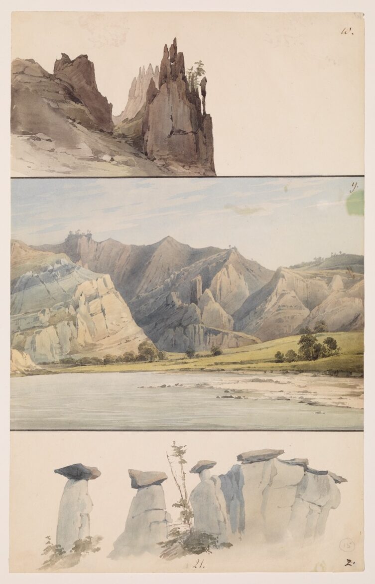
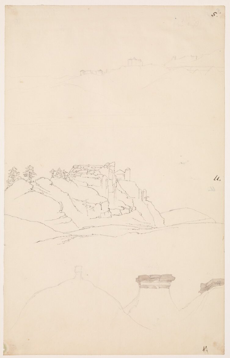
The night was calm and nice; the morning, clear and warm. In the early sunshine, we saw the singular clay and sandstone elevations all around us in the most beautiful illumination. Unusual domes appeared on them; they are bare, graybrownish, and partially overgrown on top with individual conifers. Mr. Bodmer sketched several striking domes to the left (see sketches V. and W.). On the left bank, along the river below, there was a small forest where we saw animals. Papin and Deschamps ran there, and the latter shot a bison bull. A bull elk fled into a small willow thicket on a little island close to the left bank, where it was not disturbed. At 7:30, 80°F [26.7°C].
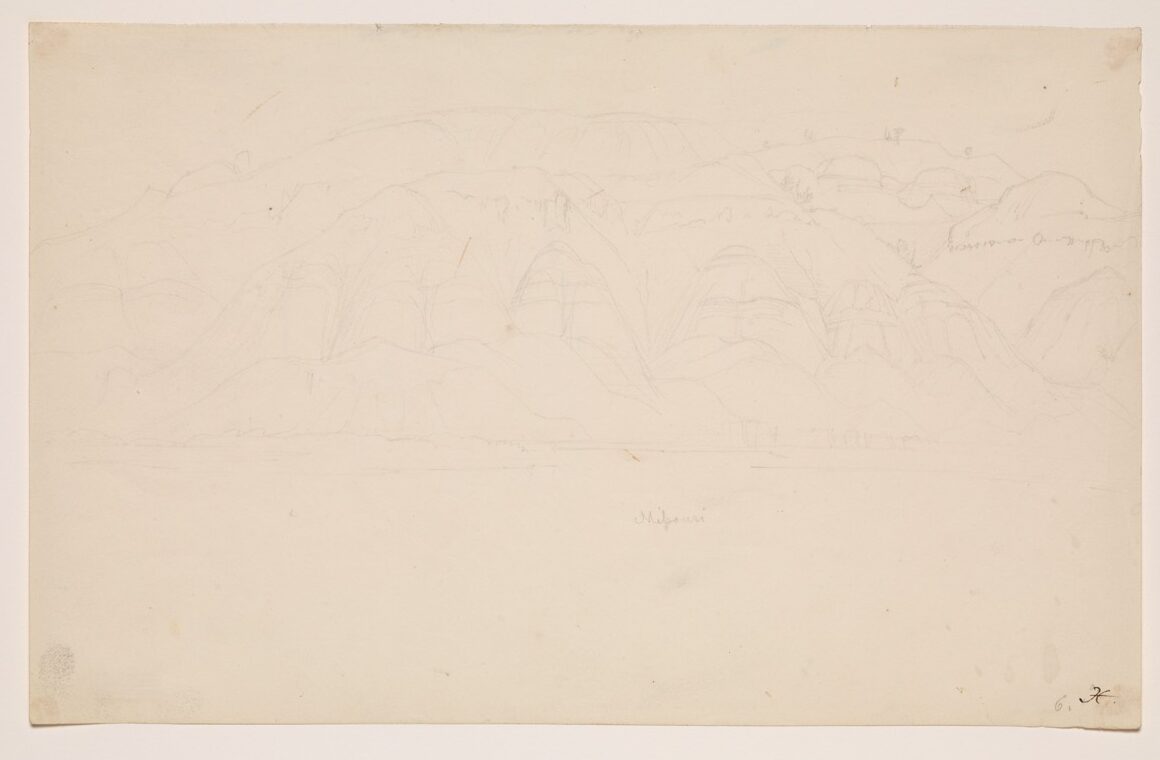
Before us we had a high mass of bare hills on which a row of ridges, regularly divided by ravines, projected. The front section of these ridges formed round, regular peaks (see sketch X.). This section of the hills is located precisely on the left bank of the right bend of the river. There is a place at the right bank in the river here—exactly where there was just enough water for the boat—that is called le premier Rapide. Here the river has boulders or rocks on its bottom that give it a little more fall or swiftness, and one had to assist the men on the cordelle with poles. We put this spot behind us and then turned right.
The bare elevations became higher and higher, for we were approaching the high, rugged mountains that are called les Mauvaises-Terres. Lewis and Clark characterized this region by noting that the river flows through a mountain range. Throughout the entire stretch, there are no tributaries and brooks at all. [The] high, bare mountains are at the same time the principal haunt of the argali (bighorn, grosses cornes), which, to be sure, [could be] found earlier but not in such numbers. There is no longer any forest in that stretch of mountains, either, and one cannot expect to get any game there other than the bighorn. In the bend of the Missouri where we were now, the most unusual sandstone domes, mostly a yellow-reddish color, appeared along the mountains. [There were] protruding strata as well, eruptive, jagged, and tumbled down with the rubble; round, smooth peaks protruding and marked with perpendicular channels and furrows; as well as wall-like formations, in some places perfect imitations of the ruins of mountain castles along the Rhine. We saw to the right, after the second bend of the river facing a jagged mountain range, a figure that perfectly resembled an old tower [that] stood near the mountain. It was located north of us (hora 1 toward the west; see sketch Y.). The water was shallow at the bend where we still were. The men on the cordelle were up to their waists in water. On the promontory to the right, which was a flat, rocky area, we stopped and took in the crew in order to cross to the left bank into deeper water. Dreidoppel brought along Solidago [— —], which was blooming here [as well as] five to six days earlier, with very fiery yellow flowers such as all these plants have.
Having arrived on the left bank, we stopped awhile, and Mr. Mitchell went with Deschamps to look for the elk hidden on the small willow island now somewhat behind us. I had no desire to accompany them there, since one had to wade through nothing but mud and water. Dreidoppel had brought back some [specimens of] Unio and caught a frog that was marked with beautiful green spots. It seems to me still undescribed and bears some resemblance to a young toad. The hunters returned; the elk was no longer there. We moved on, but the water was very shallow. They shoved with poles and worked strenuously; the men had all undressed and made their way alongshore up to their shoulders in water.
We lay off shore for a while; Messrs. Mitchell and Bodmer went out to look for bighorn. We looked to the right into a lateral valley from which a swift creek emerged; Lewis and Clark called it Wincher’s Creek [and] said it has some water and is about 30 paces wide. Dreidoppel, who had gone over to its bank, heard a loud rushing sound, because it forms a little cascade. In its valley one sees the most unusual hills and domes rising up one behind the other. This region of the Missouri is the beginning of the so-called Mauvaises-Terres, high bare mountains without water where the bighorn lives, as I have already mentioned on [manuscript] p. 201.
Along the right bank extended a row of long high plateaus, whitish gray [and] bare, [of] sandstone with clay domes, on which were a vertical furrow and protruding ledges and ridges. Also on the left bank, [there] were mountains like these, but mostly [with] some prairie before them. The men on the cordelle were chasing the small striped chipmunk.
At eleven o’clock thunder was heard, just a few times. The thunderstorm passed over. At twelve o’clock, 83°F [28.3°C] in the cabin. Wind cooled off the heat somewhat. Our men pulled [on the cordelle] deep in the water. At twelve o’clock we reached an island without forest, which undoubtedly is more recent than Lewis and Clark’s journey and which they seem not to have mentioned. The striking high sandstone and clay mountains continue to extend along both sides of the river. They are frequently divided by gorges. Several peaks on top of them, and toward the front, roundish protruding domes or outcroppings, one after the other. All of them are completely grayish brown or whitish gray, barren, [and] mostly without vegetation, which only appears as a light cover with small bushes and some grass on the ledges, furrows, and ravines.
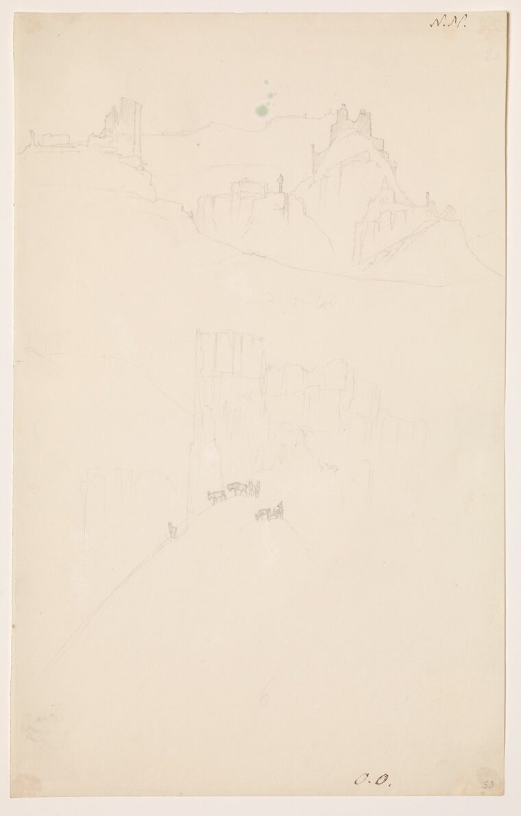
About 12:30 we found Mr. Mitchell and Bodmer waiting for us with several men along the left bank under a ledge of rock. They were brought on board; they had seen nothing other than a hare and a striped ground squirrel. We soon ran aground, and the crew worked strenuously to push the boat away from the bank. The mountains on the right still had the formation of the one [shown] in sketch X. The wind was contrary, and the voyage proceeded very slowly. We reached the outlet of a brook on the right bank that Lewis and Clark on their map call Soft Shell Turtle Creek. In the prairie before it, we saw a large bison walking slowly about. On its upper bank, there were some striking mountain masses that had walls that perfectly resembled demolished old mountain castles. All these mountains bear the closest resemblance [to] many areas of European Switzerland. The large yellow-and-black butterfly with a red eye and blue and black borders (Papilio [— —]) was not uncommon throughout this region. Now I caught it, too.
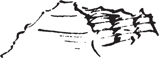 Incredible mountain elevations to the left, including one like a Brazilian church with a gable in front and several points on the roof, others like a sugarloaf, etc. Ravines between them. Facing us along shore, they now had mostly rounded tops; between them, deep lateral valleys. At their base, mostly narrow, level, often gradually sloping prairie, covered with Artemisia and the aforementioned thorny shrub, which extends to the river.
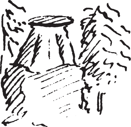 In [the] prairie, not far above Soft Shell [Turtle] Creek, we heard the calls of prairie dogs. In a lateral valley stood isolated sandstone figures with flat, broad tops, [all] like tables on broad pedestals; beneath [each], a large quadrangular base; individual conifers shaded [the] sides. In this manner the whole region is full of strange, unusual formations that cannot all be described. For the abovementioned turret see sketch Z. In the next lateral valley, one saw three cones standing above on an inclined sandstone bench, like regular pillars with a roundish capital;
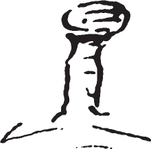 Mr. Bodmer sketched them (see sketch A. A.). Scarcely 100 paces farther [along], one again saw cones of clay, rising high on an incline, just as I saw them in Switzerland in 1808 on the great Glacier des Bossons on Mont Blanc (sketch B. B.). Opposite, on the right bank, the hills still had the shape of sketch X., that is, [they] were mammiform. Here in the Mauvaises-Terres, as already noted, [there was] no forest and only very rarely were trees seen along the river. Grassy areas, extremely narrow, appear here and there.
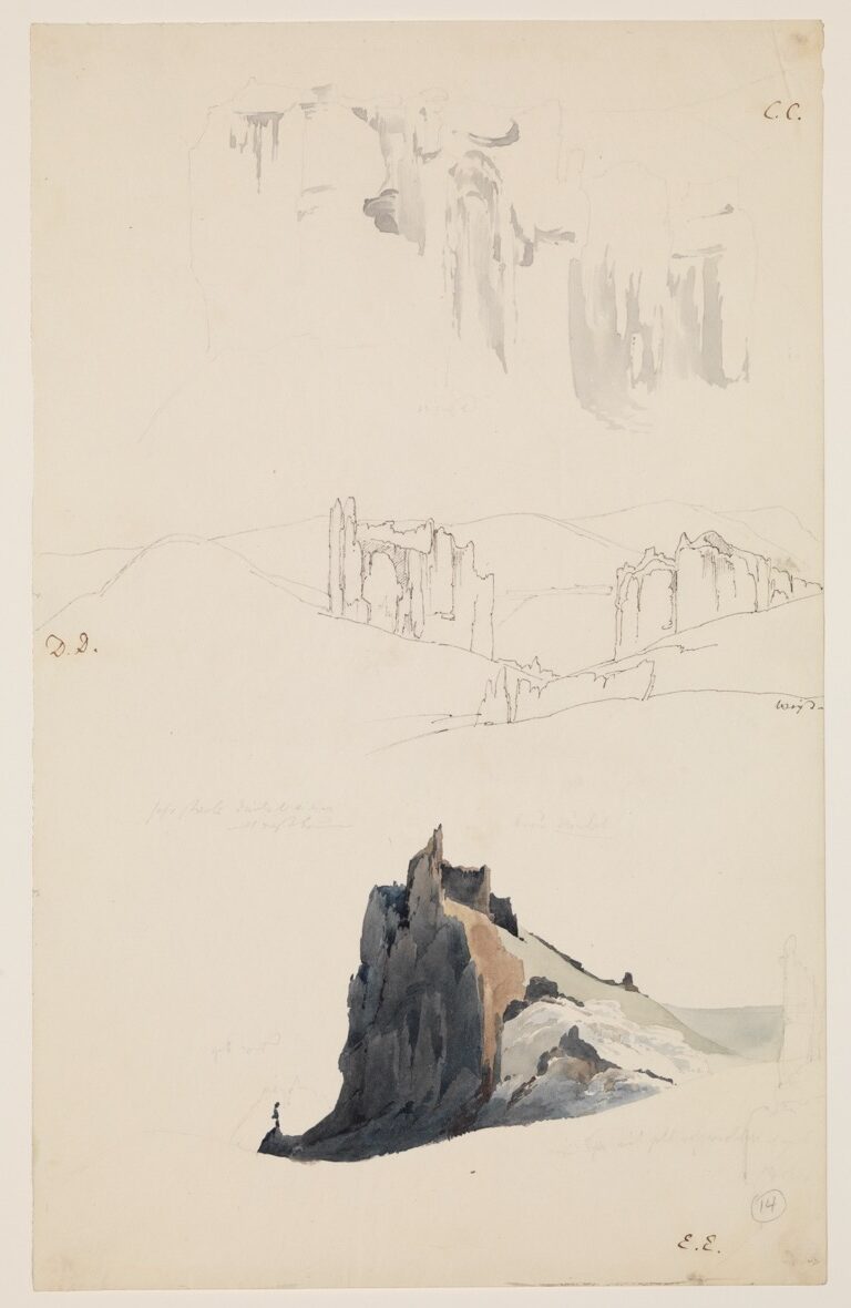
The river now turns left around a level promontory, covered with prairie and jutting far out; in front of [this was] a sandbar, which the men on the cordelle crossed after they had been wading deep in the river. One of them caught a young wild goose alive; it was brought on deck, where, however, it immediately escaped. 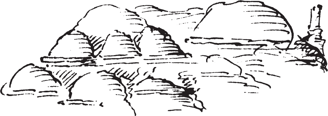 The massifs on both sides now had rounded shapes, that is, in front of the high, rather rounded hills rest smaller ones, which were likewise rounded and semispherically shaped. Several of these conical peaks followed, some of which Mr. Bodmer sketched (see sketch C. C.). Columnlike shafts stood upright on the edge of a mountain, not far from its base. Immediately above these pyramids we reached an island that Lewis and Clark also mention but without naming it. From here it was not far to the rapid called Elk Fawn Rapid, according to Lewis and Clark. First of all, we had to overcome a rapid near a little bend of the river to the left, where everyone lent a hand. This difficulty was surmounted after strenuous effort. Deschamps returned from hunting and had shot nothing but a male hawk, or sparrow hawk (Falco velox), which had caught a blackbird.
At five o’clock a thunderstorm gathered; no air was moving; it was very hot. We lay quietly at the left bank, [then] moved on. We immediately passed a few wide lateral gorges on the left bank filled with large blocks of rock with scattered, crooked pines. 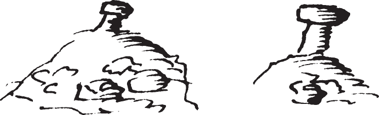 In the background, hills on which isolated columns stood, each of which supported a large block of sandstone; the column was ash-gray, the rock yellowish red. Such cones, or rather cylinders, which support a rock, are extremely common here; they are remnants of eroded clay strata on which a sandstone stratum [once] rested. The gray, roundish, towering, mountainous masses have the appearance of the Swiss mountain ranges. [We passed] an island overgrown with willows.
Somewhat farther on, when the sun had set, we saw several bighorn standing silhouetted against the sky on top of the highest [peak] of the mountains, about as high as the highest Rhenish hills. With the telescope one could see them clearly. Although it was already late, Mr. Bodmer immediately volunteered to attempt the climb. Papin went ahead, and Dreidoppel followed but remained at the bottom of the mountain. Meanwhile Doucette discovered a beautiful piece of petrified wood on the shore that was blackish and very solid, probably from Juniperus virginiana. We smashed it with difficulty, and I took several pieces with me. Deschamps went out to our bank and killed a rattlesnake close to the boat. The thunderstorm had dispersed, and the evening was very pleasant. At nightfall the hunters returned. They had seen three bighorn, which, however, they did not get.