Journey from Fort Pierre on the Teton River to Fort Union on the Yellowstone River
Stay at Fort Pierre – The Dacotas (Yanktons and Tetons) – The Yellow Stone returns; we travel on the Assiniboine – Difficult voyage – Cheyenne River – Cheyenne Indians – Antelope and elk – Little Cheyenne – Good day of hunting – Moreau’s River – Rivière du Rampart – Two Arikara villages – The Arikara Indians – Cannonball River – Old Mandan village – Heart River – Storms and bad weather delay us – Meeting with the Yanktonais (Dacotas) – Arrival at Fort Clark – The Mandan, Hidatsa, and Crow Indians – Five villages of the Mandans and Minitaris (Gros Ventres) [Hidatsas] – Meeting with the Hidatsas – Little Missouri – Difficult navigation around a promontory – Fire aboard ship – View of the first bears – Two Blackfoot Indians – Meeting with the Assiniboines – First glimpse of the bighorn – Muddy River – Second meeting with the Assiniboines – Yellowstone River – Fort Union
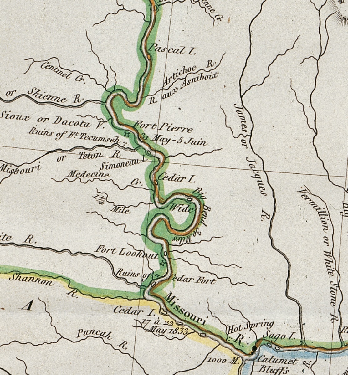
June 13, 1833
Early in the morning, bright, beautiful sunshine, some wind. During the night the river rose 3 1/2 inches; it brings tree trunks, wood, twigs, chips, etc., down with it. The region is attractive. On both sides of the river, [there are] lowlying lands with cottonwoods and willow thickets; an island to the left; varied green prairie hills. We strike sand; the lead is often tossed out. Since the Arikara villages, we have passed two creeks on the right bank, one of which the Arikaras call Blind Buffalo Creek (Okoss-Tírikarúch.) On the left bank, gray sand and argillite bluffs. Here in the bend of the river, on the western bank, Manuel Lisa had built a fort, or trading post, of which nothing more remains; this place is still called Manuel’s Fort. Beyond the bend of the river, along the eastern bank, [one sees] a row of unique table-shaped hills, flattened on top lengthwise with several clefts; before them along the river [are] tall, detached groups of trees. To the left, extensive lowland with cottonwoods and willow thickets. A heron on a sandbar—a rare occurrence. Large sandbars before us in the river.
At seven o’clock we put in at the right bank and cut wood; here another kind of pomme blanche with a beetlike root, which makes the grizzly bears very fat, grows copiously. When too much of it is eaten by humans, it causes stomachache. The hill chains are now becoming flat, the view panoramic; large, flat expanses of sand and willows at the promontories of the bends of the Missouri, here and there enclosed by a forest border. To the left along the high bank, below cottonwood forest and willows, [there are] a beaver hut, beaver path, and gnawed-off tree trunks. A goose (Anser canadensis) with goslings already large. Above the promontory to the right, one sees in the distance a distinctive hill with several unique domes; it is called la Butte au grès. The prairie and the beautiful domes peeking over it give the region here a more interesting appearance than yesterday. Today the prairie is much greener and more attractive. Buffalo bones bleaching out there remain as remnants of Indian meals. Tall buffalo berries. Large quantities of trees, limbs, chips, etc., float in the river. To the left, a pretty creek without a name; Lewis and Clark probably call it [— —]. To the right, a beautiful, tall cottonwood forest with tall, sturdy trunks; an hour later there is a similar tall forest to our left. In the background, several outstanding domes [in addition to] the above-mentioned Butte au grès (called Skatarárisch in the Arikara language), which we soon lose sight of behind the closer hills.
After lunch someone suddenly called out that there were Indians in the vicinity. On the left bank in the prairie, we saw a man who fired three times with his gun. [We] thought him to be a hostile Arikara, but soon a canoe appeared with still another man. They were men from the company who came from the falls of the Missouri with letters for Mr. McKenzie. They were taken on board, and they left their small [bullboat] lying unused on the bank. Several days’ journey upstream they had seen very many wild animals. We sailed to the right bank and struck bottom several times. On the bank among the bushes beneath the willows there were very many blossoming wild roses.
A quarter of an hour farther, we halted after two o’clock near a beautiful cottonwood forest to cut wood. Mr. Bodmer and Dreidoppel went out, found numerous bison and elk trails, and saw blackbirds, the yellow woodpecker (Picus auratus), and the catbird (Turdus felivox). On land it was very hot. Dreidoppel brought a nice grass ([— —]) on board. We continued and to the right saw long prairie hills, steeply slanted in front like fortress ramparts and marked with perpendicular furrows; before them, extensive lowlands again with cottonwood and willow, where there were many elk. A dead bison floated past the ship. Prairie hills covered with a soft green carpet; dense woodlands on shore alternate on both sides of the river. Ducks and a large gull (Larus). To the left in the distance, a hill chain with many high domes; it is located in the vicinity of the Cannonball River. Closer to the river, a range of hills flattened on top with several clefts, called la Butte de Chayenne. Beautiful, tall, shady cottonwood forest to the right along the bank; urubus hover over it, and a tall tree was covered with them. At six o’clock a dark thunderstorm arises in the northwest; after seven o’clock it is black and threatening before us. We put in at the right bank and cut wood. A very heavy rain pours down as night approaches. Mr. Bodmer claimed he had seen a bison.